 |
Friends of the Corve and Teme Ludlow's flood action and river environment group |
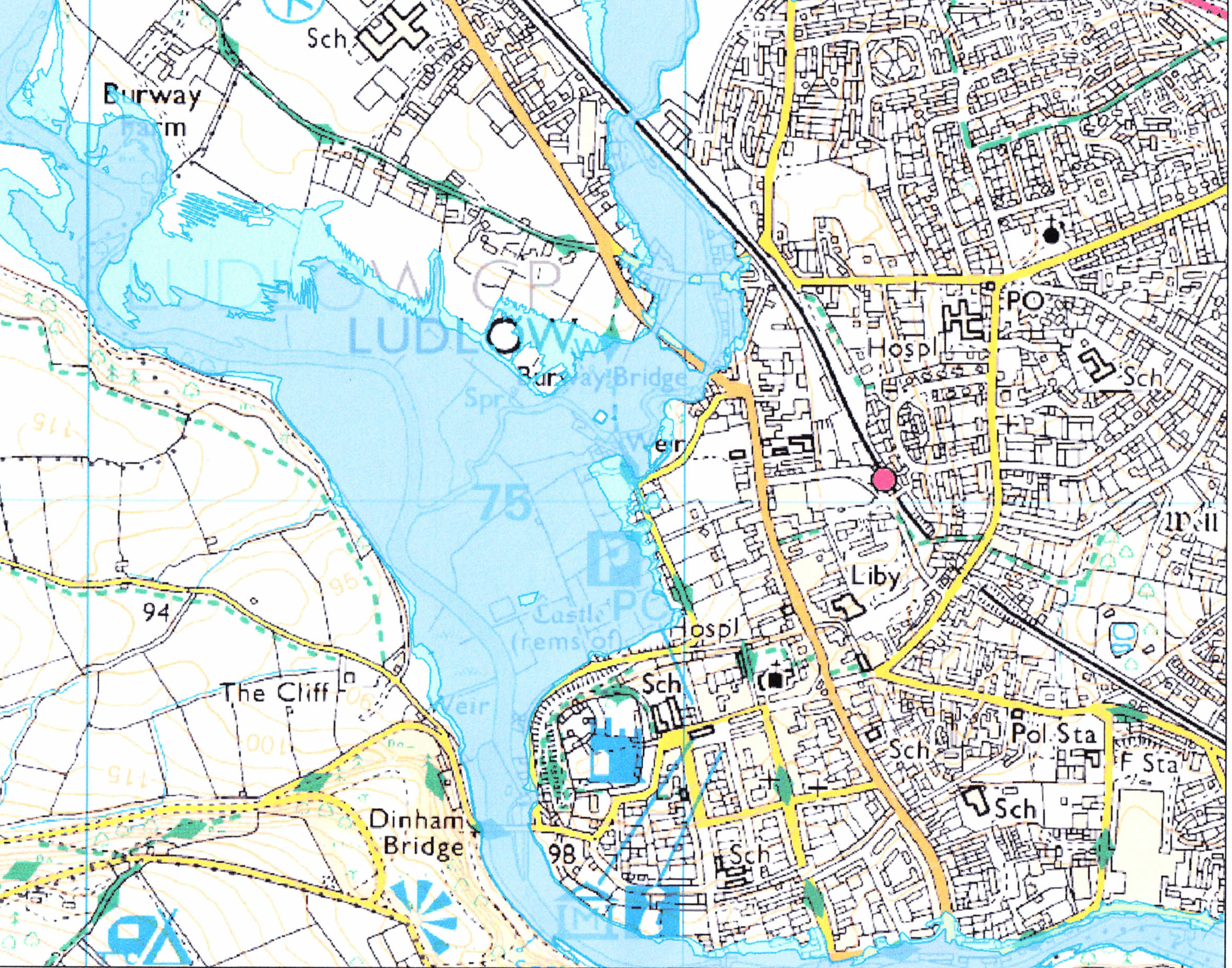
Flood zone map of LudlowThis is the Enivronment Agency's flood zone map of Ludlow. The confluence of the rivers Teme and Corve forms a huge flood-prone area that includes the railway, the road bridge on Coronation Avenue, the recreation grounds alongside Linney, and a number of existing and planned residential areas. This is not to say that other areas of Ludlow downstream of Dinham Bridge are not flood-prone; just to say that those flood zones are smaller in extent.
This page contains Environment Agency information ©Environment Agency and database rights.
|
Terms and Conditions of Use of this Website
By using this site you confirm that you accept these terms of use and that you agree to comply with them. If you do not agree to these terms, you must not use this site.
FCT is the owner or the licensee of all intellectual property rights on this site, and of the material published on it. Those works are protected by copyright laws and treaties around the world. All such rights are reserved.
You must not use any part of the content on this website for commercial purposes without obtaining a licence to do so from FCT or its licensors.
You may print off one copy, and download extracts, of/or any page(s) from this site for your personal use and you may draw the attention of FCT within your organisation to content posted on its site. You must not modify the paper or digital copies of any materials you have printed off or downloaded in any way, and you must not use any illustrations, photographs, video or audio sequences or any graphics separately from any accompanying text. All identified authors and contributors of content on this website must always be acknowledged.
If you print off, copy or download any part of FCT’s website in breach of these terms of use, your right to use the site will cease forthwith and you may be requested by FCT to return or destroy any copies of the materials derived from the web site in your possession.
Disclaimer
The content of this site is provided for general information only, and is not intended to amount to advice on which you should rely. Before taking (or refraining from) any action based on the content of this site you must obtain professional or specialist advice.
Although FCT makes reasonable efforts to update the information on this site it makes no representations, warranties or guarantees (whether express or implied) that the content on its website is accurate, complete or up to date.
FCT has endeavoured to ensure its accuracy but makes no guarantee concerning the information described herein, nor its usage in and/or applicability to particular situations. FCT accepts no liability for the consequences of the use by others of any information acquired or accessed via this website. FCT reserves the right to alter or modify the contents of this website at any time without notice. |
Friends of the Corve and Teme About us News and Events What can be done Flood history Contact FCT
